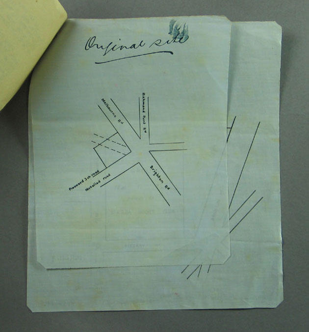
Map of proposed cricket club location, possibly Richmond Cricket Club - c1850s
Object Type
Documents and books/Document/Letter
See full details
Object Detail
Brief Description
Simple, small map on blue sheet of either glossy paper or glossy material. Title at top reads 'Original site'. Depicts intersection of Richmond Punt Rd, Melbourne Rd, Brighton Rd and a proposed road. This map is attached to 9 other documents with a metal butterfly clip.
Measurements
0 - Whole: H: 200 W: 160 D: 1mm (H: 7 7/8 W: 6 5/16 D: 1/16")
Location
In storage
Registration No
M9611.9
Share
Comments
Be the first to comment.