Map of Auckland, British Empire Games 1950
Object Type
Documents and books/Document/Map
See full details
Object Detail
Brief Description
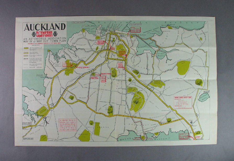
Map of Auckland indicating the venues for the IVth Empire Games and the transport routes used to get to them. It also shows places of interest such as national parks and golf courses. On the back, printed in black, is more information about the venue, listed by sport.
Measurements
H: 291 W: 454mm (H: 11 7/16 W: 17 7/8")
Location
In storage
Registration No
2003.3903.567
Credit Line
Donated through the Australian Government’s Cultural Gifts Program by a private collector.
Comments
Be the first to comment.